
With contributions by Avantika Deb, Bumjoon Park and Ramya Dilipkumar
Location is crucial in travel risk intelligence. Whether it’s a sudden transport strike, a fast-moving wildfire or an unexpected border closure, accurately identifying where an incident is taking place is just as important as understanding what is happening. When people’s safety and travel plans are on the line, vague geography isn’t good enough.
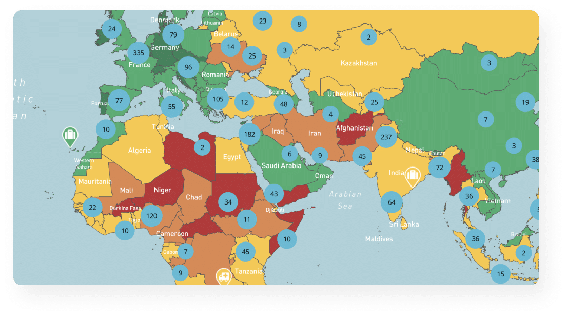
At Riskline, we use a combination of map pins, ISO country/region codes and airport identifiers to pinpoint the exact location of emerging threats. These tools help us deliver alerts that are precise, easy to understand and useful to travellers, travel managers and partners, especially when time is short and the stakes are high.
Choosing Impact Type and Locations
Every alert starts by assessing the disruption type, whether it affects long-distance travel or local commuting. For example, a nationwide rail strike in France needs national attention, while a Paris metro disruption mainly concerns local commuters.
Once the nature of the event is established, the next step is selecting the most meaningful geographical markers. These range from countries and regions to specific cities, neighbourhoods or transport hubs, depending on the scale and scope of the incident.
For major events, such as nationwide elections in countries like the United States, national-level tags are used to reflect the broad impact. To aid map readability, a key hub or capital city may also be highlighted.
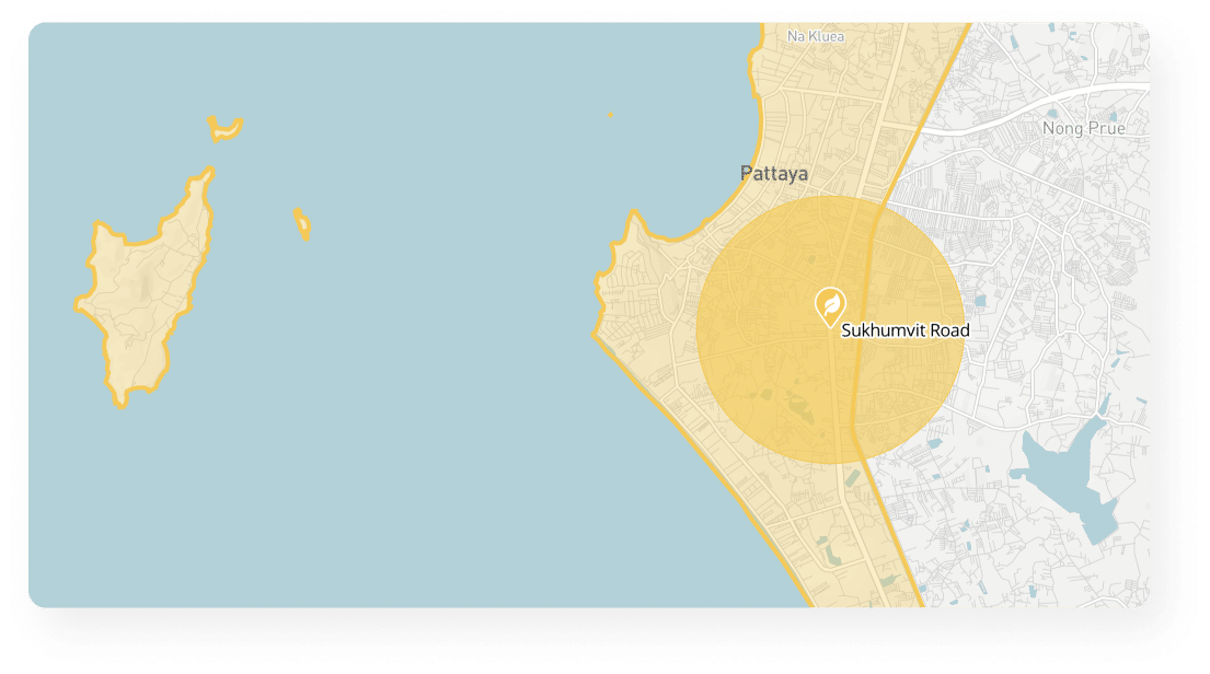
Localised disruptions, like city-centre protests or road closures, are tagged with as much specificity as possible. This may include a street address, a well-known landmark or the name of the neighbourhood in question.
Where an incident occurs near a major airport, the airport may be pinned to indicate potential disruption to air travellers, but only if the event is directly relevant to airport operations or access.
Making Exceptions: Combining Locations and Regions
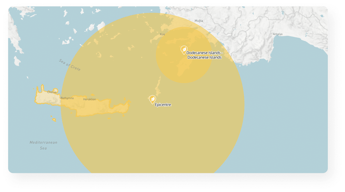
While alerts typically use either a broad area or a specific location, some events call for both. For fast-moving or widespread disruptions, like severe storms, floods or protests, a dual approach ensures accuracy. Alerts may list affected regions while also pinpointing specific cities or coastal zones most likely to be impacted.
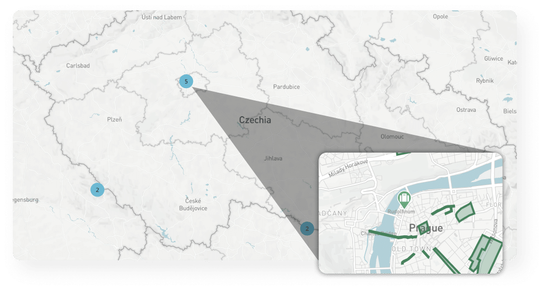
Earthquake or tsunami alerts may show multiple epicentres on the map, alongside broader regional warnings.
Multi-Country and Cross-Border Alerts
Some disruptions don’t respect borders. In the case of major air traffic control failures or cross-border cyber outages, alerts are issued for each impacted country individually. A pin is typically placed on the capital or major hub to keep things readable at a glance.
When a conflict or unrest affects multiple countries, the map reflects both sides of the border. Tags and pins are selected to highlight key impact zones. This helps clients understand the broader geographical context without overwhelming them with unnecessary detail.
ISO and Airport Codes: Supporting System Integration
Not all location markers are visible to the end user, but they play a vital role in the background. ISO codes, used to identify countries and regions, are built into alert metadata, This allows partners to filter and display relevant information seamlessly across their platforms.
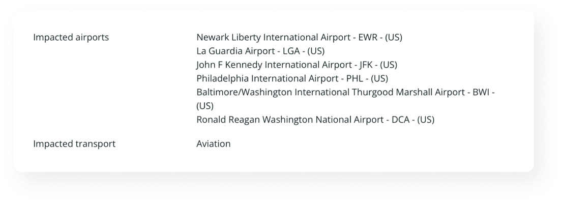
Airport codes, however, often appear directly in the alert text. IATA and ICAO codes are especially important for clients monitoring air travel. They make it quicker and easier to understand and filter out which routes or hubs may be affected.
While a consistent framework guides how locations are selected and mapped, flexibility is essential. Rather than enforcing rigid rules, the focus is on delivering clarity and relevance. Each alert is crafted to provide the right level of geographic context, never to overwhelm. In travel risk intelligence, it’s not just about marking a place on a map. It’s about offering meaningful insight that helps people navigate uncertainty with confidence. Because in the end, understanding the context of risk is what truly empowers informed decisions.