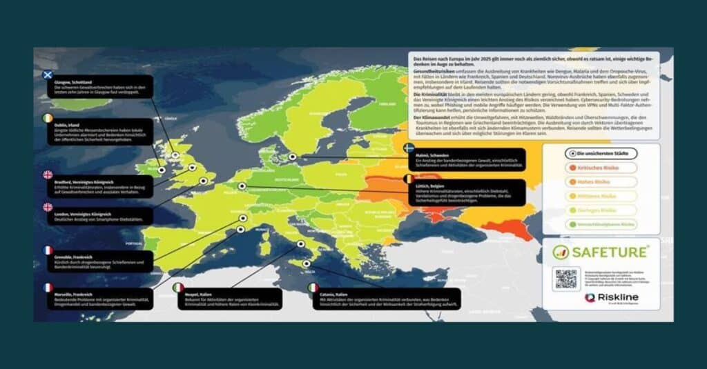
The technology provider Safeture is now offering the updated Risk Maps 2025 for all continents free of charge. Powered by Riskline’s intelligence, they provide travellers and companies with a solid foundation for assessing risks related to international travel. Countries are colour-coded from dark green (low risk) to red (critical risk), enabling a quick overview at a glance.
In addition to national-level assessments, the maps include indications of cities with particularly high crime rates, as well as information on region-specific threats such as natural disasters, political instability or infrastructure-related risks. The ten most dangerous cities on each continent (six in Oceania) are accompanied by brief explanations of the respective threats.
“Whether travelling for business or leisure, it’s important to be aware of potential risks,” says Marcel Brandt, Chief Sales Officer at Safeture. “Our updated risk maps are a practical tool to help people prepare in advance and respond quickly if necessary.”
The maps are user-friendly and clearly structured visually. For travel to high-risk areas, Safeture also recommends the use of technical solutions, such as those enabling rapid contact with an assistance provider.
The Safeture Risk Maps 2025 are available for free download now at:
www.safeture.com/riskmap
Read the full article in German in Tourexpi.
Photo credit: KC3 Köpers Corporate & Crisis Communications GmbH