At the Global Business Travel Association (GBTA) Europe Conference 2018 in Berlin Riskline launched City Safety Maps project. This new service will bring unique street-level safety and security information, a first in the travel risk management industry.
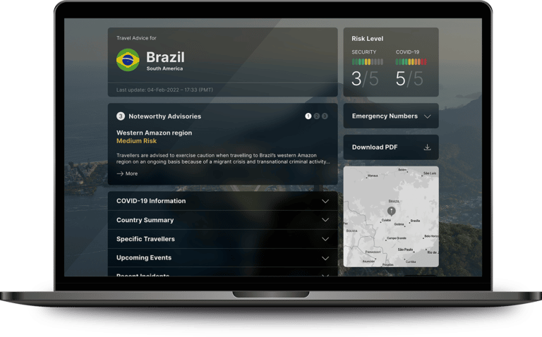
An initial 50 City Safety Maps collection is available to Riskline resellers and clients. City Safety Maps are an exciting addition to our range of travel risk management products. It will complement Riskline’s existing 244 City Safety Reports portfolio. An additional 50 maps will be available at the start of 2019, with new maps to be added throughout the year.
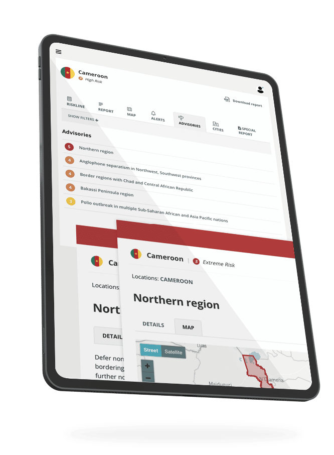
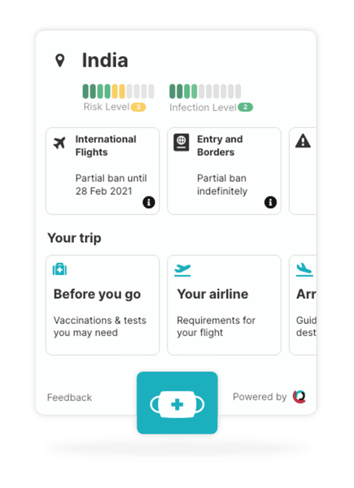
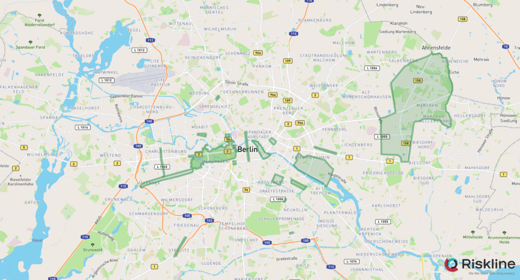
Riskline’s analysts created each map from scratch using open source and human intelligence, including reports from local authorities and trusted local sources. Every map contains critical information and advice for travellers about specific neighbourhoods and landmarks in a city, down to the street level. These locations include high-crime zones, protest flashpoints and other areas of concern.
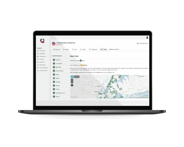
City Safety Maps will be available through the Riskline portal as part of existing City Safety Reports. Also, through an API, which companies can incorporate into travel and duty of care apps.
—
About GBTA
The Global Business Travel Association (GBTA) is the world’s premier business travel and meetings trade organization headquartered in the Washington, D.C. area serving stakeholders across six continents. GBTA and its 8,000+ members represent and advocate for the $1,357 trillion global business travel and meetings industry. GBTA and the GBTA Foundation deliver world-class education, events, research, advocacy, and media to a growing global network. For more information, visit gbta.org and gbtafoundation.org.